
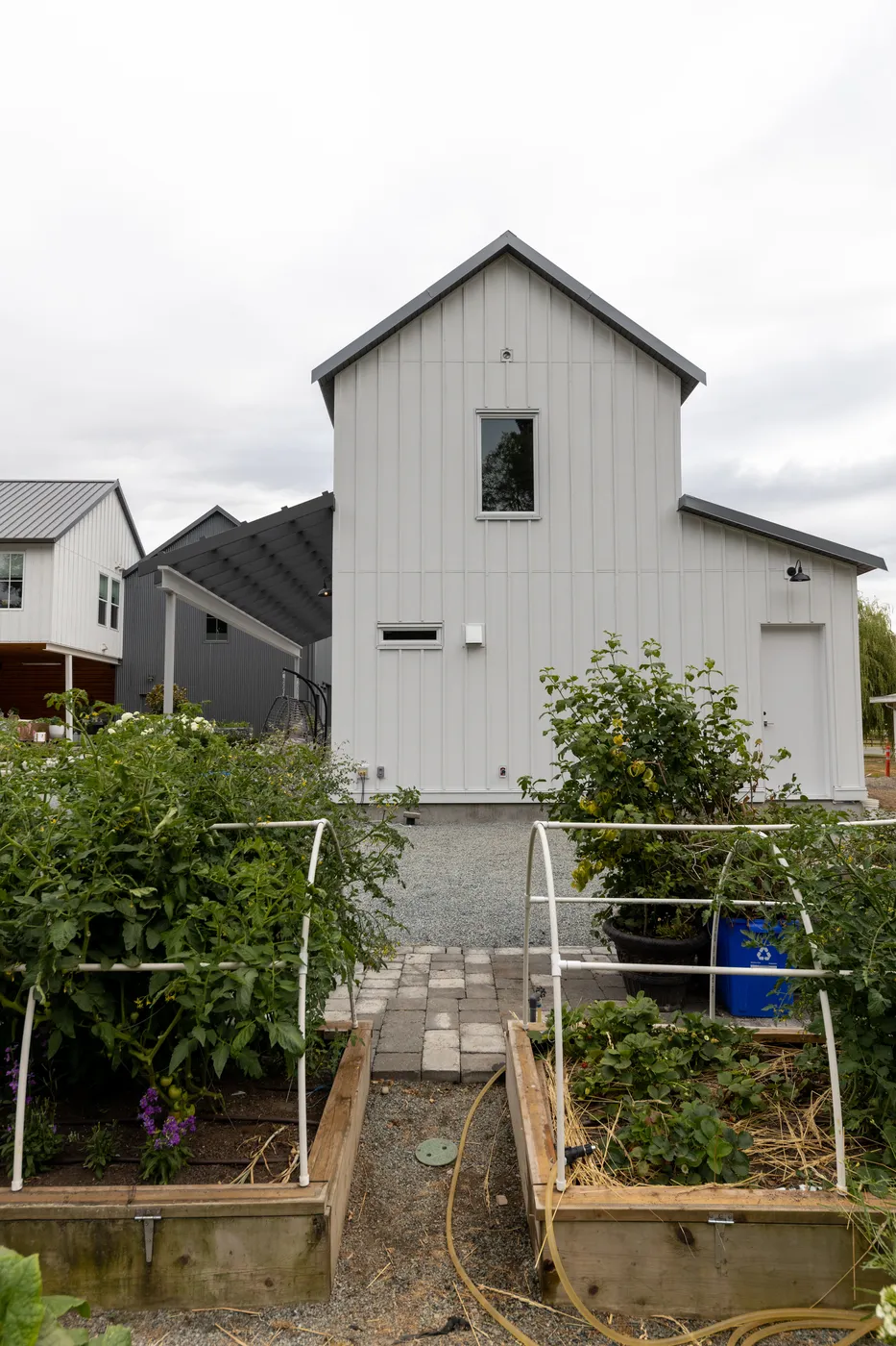
This page covers the Township of Langley's land outside its six urban communities: farms along the Fraser River in Glen Valley, one-acre lots in the Salmon River Uplands, the old settlement of Milner, and the acreages around Campbell Valley Regional Park. The Township's Rural Plan, Bylaw 3250, has covered this land since July 12, 1993, but each place has its own zones, lot sizes and water supply. We are a [custom home builder in Langley](/areas-build/langley), with our office at Suite 351, 505-8840 210 Street.
- Rural Plan adopted
- July 12, 1993
- Rural Floodplain zone lots in Glen Valley
- 105 of 185
- Median SR-1 lot, Salmon River Uplands
- 4,220 m²
- Milner SR-2 lots on sewer and water
- 28 of 32
What we build in rural Langley
- Custom homes on RU and SR acreage lots
- Homes on Rural Floodplain lots, built to the flood construction level
- Garden suites and additional residences within the zone and ALR limits
- Detached workshops, garages and barns
- Renovations and additions to older farmhouses
- Septic and well work coordinated with a Registered Onsite Wastewater Practitioner and a registered well driller
Recent work
Country Shop is a barn-style detached workshop we built on a rural property in Langley. The client wanted it insulated and powered for use all year, with low upkeep and a finished look that fits the property around it. It took 4 months to build.
See Country ShopIn short, Building or renovating a home in rural Langley: Glen Valley, the Salmon River Uplands, Milner, Campbell Valley and South Otter, all under the Township's Rural Plan (Bylaw 3250, 1993). Township records place 105 of the Township's 185 Rural Floodplain zone lots in the Glen Valley area, where the flood construction level along the Fraser is 7.54 m to 8.26 m. The Salmon River Uplands has 1,872 SR-1 lots with a median of 4,220 m², 566 with Township water and 5 with sewer, over the Hopington AB aquifer. Milner's 32 SR-2 lots (median 1,496 m²) sit in Development Permit Area C. Campbell Valley Regional Park is entirely in the Agricultural Land Reserve.
What the Rural Plan sets for every rural lot
The Rural Plan sorts the Township's rural land into designations, and the minimum size for a new lot follows them. In the Agriculture/Countryside designation it is 8.0 ha (19.8 acres). In Small Farms/Country Estates it is 1.7 ha (4.2 acres). The Salmon River Uplands has a designation of its own, and Milner is one of the plan's rural commercial centres. On reserve land the Agricultural Land Commission still reviews every subdivision on farm grounds. The plan was last amended on April 27, 2026.
Section 8.3 of the plan sets the servicing rules. Every new rural development needs a domestic water supply, which may be a proven source of drinkable groundwater. Sewage goes to a disposal system approved by the Medical Health Officer, unless a community sewer can be connected, and a piped storm sewer is normally not required. Township parcel records show the result: of 802 lots in rural zones in the Glen Valley area, 8 show Township sewer and 52 show Township water.
Horses are part of rural Langley. The plan quotes a 1990 horse industry profile that put the industry's economic impact in Langley at $40 million a year, and it asks the Township to consider equestrian trails along some rural roads. Zoning Bylaw 2500 counts keeping, boarding, training and renting horses, and riding lessons on site, as an agricultural use. Equestrian centres and riding stables are a separate use, which the RU-1 zone lists by name.
Our page on acreage and farm homes in Langley covers the reserve's house size and fill rules, and septic and well permits, for any rural lot.
Glen Valley area
- Main house zones (land parcels)
- RU-1 393, RU-3 236, RU-5 101, RU-2 68
- Median lot size
- 2.0 ha (RU-1 lots)
- In the Agricultural Land Reserve
- 772 of 802 rural-zoned lots
- Township sewer and water
- Sewer on 8 and water on 52 of the 802
- Rule that sets it apart
- 105 lots in the Rural Floodplain zones
Salmon River Uplands
- Main house zones (land parcels)
- SR-1 1,872, SR-3 183, RU-1 128
- Median lot size
- 4,220 m² (SR-1 lots)
- In the Agricultural Land Reserve
- 339 of 2,244 land parcels
- Township sewer and water
- Sewer on 5 and water on 566 of the 1,872 SR-1 lots
- Rule that sets it apart
- Rural Plan section 5.7 on stormwater and the aquifer
Milner
- Main house zones (land parcels)
- SR-2 32, SR-3 6, RU-3 6
- Median lot size
- 1,496 m² (SR-2 lots)
- In the Agricultural Land Reserve
- 3 of 61 land parcels
- Township sewer and water
- Sewer and water on 28 of the 32 SR-2 lots
- Rule that sets it apart
- Development Permit Area C with a pioneer settlement design theme
Source: Township of Langley open data, Parcel Attributes and Communities layers, and the Township's TOL_Community_Areas map layer (read October 28, 2026); Township of Langley Rural Plan Bylaw No. 3250
Glen Valley: farms on the Fraser and the floodplain zones
BC's geographical names office places Glen Valley on the south shore of the Fraser River in the northeast corner of Langley. The Rural Plan calls the ridge above it the Township's main bluff, and it names the Glen Valley Bluffs as forest that gives wildlife habitat. The plan also allows fur farms and dog kennels in the part of north Langley between Fort Langley and Glen Valley, and the RU-2 zone, which permits them, covers 68 lots in the Glen Valley area.
The Township keeps a map of community areas built from census tracts, and its Glen Valley area also takes in the industrial lots on Gloucester Way. In that area we counted 802 land parcels in rural zones on October 28, 2026. RU-1 is the largest group, with 393 lots and a median mapped size of 2.0 ha (4.9 acres). Half of them are between 1.70 and 2.04 ha, close to the 1.7 ha RU-1 minimum for a new lot. 772 of the 802 are in the Agricultural Land Reserve.
Glen Valley holds most of the Township's Rural Floodplain zoning. Of the 185 land parcels zoned RU-4, RU-5 or RU-5A across the Township, 105 lie in the Glen Valley area. The RU-5 lots there are mostly on 88 Avenue (20), 272 Street (19) and 264 Street (12). In RU-5, a house floor must reach the flood construction level, and it can get there by raising the structure, by placing up to 0.91 m of fill, or both. RU-4 is stricter: the undisturbed natural ground under the house must already be at that level, and fill cannot be used. In both zones, a BC Land Surveyor certifies the elevation and a qualified professional certifies the sewage system before the permit is issued.
The flood construction level is the Fraser River's designated flood level plus 0.6 m, adjusted for distance along the river. Glen Valley lies upstream of Fort Langley, where Zoning Bylaw 2500 sets the designated flood level at 6.94 m, and downstream of the Abbotsford border, where it is 7.66 m. So the flood construction level there falls between 7.54 m and 8.26 m (Geodetic Survey of Canada datum), and the exact figure depends on where the lot sits along the river. The Township's drainage records list a Township-owned dike in the area, the Glen Valley West Wing Dike. On reserve land, the Commission's fill allowance for a house applies only while the fill stays within the floodplain elevation requirement, so we check both limits on the same site plan.
- Township land parcels in the Rural Floodplain zones (RU-4, RU-5, RU-5A) that lie in the Glen Valley area
- 105 of 185
- Most fill allowed under a house in the RU-5 zone to reach the flood construction level
- 0.91 m
- Flood construction level along the Fraser between Fort Langley and the Abbotsford border
- 7.54 to 8.26 m
- RU-1 lots in the Glen Valley area, with a median mapped size of 2.0 ha
- 393
Source: Township of Langley Zoning Bylaw 2500, Sections 105, 204, 205 and 205A; Township of Langley open data, Parcel Attributes layer, and the Township's TOL_Community_Areas map layer (read October 28, 2026)
Salmon River Uplands: one-acre lots and the Hopington aquifer
The Township's Communities map draws the Salmon River Uplands at 1,962 hectares. Its community plan lets the Uplands develop at the gross densities in the current Zoning Bylaw, with Agricultural Land Commission approval where the land is in the reserve. The Rural Plan notes that some land set aside for development there is inside the reserve, and says the boundary should be reconsidered with the Commission.
On October 28, 2026, Township parcel data showed 1,872 SR-1 lots in the Uplands, with a median mapped size of 4,220 m² (1.04 acres); half are between 3,774 and 5,282 m². There are also 183 SR-3 lots, with a median of 1,826 m², and 128 RU-1 lots. 311 of the SR-1 lots are in the Agricultural Land Reserve, so the Commission's 500 m² limit on the main house applies to them in addition to the zone rules.
An SR-1 lot allows one house plus one accessory dwelling unit, such as a garden suite, when the house has no secondary suite. The zone also lists small-scale multi-unit housing of up to four homes, but the Township allows it only on lots with both Township water and sewer, inside the Urban Containment Boundary and no larger than 4,050 m², among other conditions. In the Uplands, 5 of the 1,872 SR-1 lots show sewer service and 1,090 are 4,050 m² or larger. Buildings can cover 33% of the lot, which is 1,393 m² on the median lot, and the house can be 9 m tall. Our page on coach houses and garden suites in Langley covers the second home.
566 of the SR-1 lots show Township water service, and the rest rely on wells. The province's aquifer record for Hopington AB (aquifer 35) gives its location as the Salmon River Uplands and describes an unconfined sand and gravel aquifer of 23.9 km², with high demand and high vulnerability. The Township's 2009 Water Management Plan reported that local well drillers saw the water table fall in the Hopington area, and that residents had drilled deeper wells over the previous 15 years as old wells dried up. Zoning Bylaw 2500 also does not allow a temporary mobile home on SR-1 land outside the reserve when the land sits over the Hopington Aquifer.
Bylaw 5983 added section 5.7 to the Rural Plan in 2024, and it asks development proposals in the Uplands to deal with rainwater and water use. Rain should soak into the ground on each lot. Designs should use low impact methods such as pervious paving, bioswales and rain gardens, and protect the local aquifer and the water that flows into the Salmon River. The section also asks the Township to consider design guidelines that protect rural streetscapes and view corridors. We plan the driveway surface, roof drainage and landscaping on an Uplands lot around those aims from the first site plan.
Milner: a rural settlement inside the urban area
Milner is one of Langley's oldest settlements. The Township's community plan says the Hudson's Bay Company ran a large farm on the Milner plateau, that the distance between the fort at Derby and this farm was one reason the fort moved to Fort Langley in 1839, and that the farm was sold at auction in 1878. Milner Church is one of the rural buildings the Township has designated as heritage. BC's names office places Milner on the BC Hydro railway line, southwest of McMillan Island.
The community plan puts Milner inside the urban development area, but says it will keep its history and character as a rural community. The Communities map gives it 21.1 hectares. We counted 61 land parcels there, along Glover Road, 216 Street, and Maxwell, Crush and Smith Crescents. The 32 SR-2 lots have a median mapped size of 1,496 m², under the 8,094 m² minimum the zone sets for a new lot, and 28 of them show both Township sewer and water.
The Milner core is Development Permit Area C in the Rural Plan. New commercial, industrial, multi-family and intensive residential buildings need a development permit, and a house on a new parcel of 930 m² or less counts as intensive residential. The guidelines ask for an early 20th century "pioneer" settlement look, a height of no more than 9 m or 2½ storeys, whichever is less, and a referral to the Township's Community Heritage Commission for design comment. A basement does not count as a storey when the first floor is less than 800 mm above the average grade. Additions under 50 m² that do not face a road and match the existing building need no development permit.
On an existing SR-2 lot, the zone allows one house, plus an accessory dwelling unit only when the lot is outside the Urban Containment Boundary and the house has no suite. Before we plan a garden suite in Milner, we confirm with the Township which side of that boundary the lot is on.
Campbell Valley and the south: acreages around a regional park
Campbell Valley Regional Park lies in the southwest of the Township, east of Surrey and White Rock and south of the City of Langley. Metro Vancouver's 2020 management plan says the whole park is in the Agricultural Land Reserve, and it describes the setting as farms, agri-businesses and homes on acreages. The plan says those acreages have changed from modest farmhouses of the last century to large modern estate homes, which park visitors can see from the park's uplands. Brookswood and Fernridge lie to the north.
To the south is Highpoint, which the plan calls a cluster of estate homes built on a former gravel extraction site. The Rural Plan's Rural Residential designation, added in 2006 by the bylaw it lists as High Point, covers the site at 200 Street and 0 Avenue, with an overall density of 0.65 homes per acre and a 0.20 ha minimum lot. That designation calls for full urban services, community amenities such as trails and passive parks, and exterior design controls registered on title as restrictive covenants.
Zoning Bylaw 2500 and the Rural Plan call the river through the park the Campbell River; Metro Vancouver calls it the Little Campbell River. The park plan says its base flows are recharged from groundwater, and that groundwater is drawn across the watershed, with demand at its peak in summer, when the river runs lowest. Five species of salmon and trout have wild populations in the watershed, and the endangered Salish sucker lives there too. For a house near the river, Section 105 keeps buildings 30 m from its natural boundary and puts living floors at least 2.5 m above it.
The park has 14 km of trails shared by riders and walkers, and its Campbell Downs area, the park's only place for horse trailer parking, has a riding ring, practice jumps and a barn. The Rural Plan allows an equestrian service centre, such as a farrier or a tack store, to be considered in the Small Farms/Country Estates area of southwest Langley.
South Otter: RU-3 farmland in the south of the Township
The Township's census-based map also has an area named South Otter, along 232 Street, Old Yale Road, 224 Street and 240 Street. It holds 540 RU-3 lots with a median mapped size of 2.03 ha (5.0 acres), and 511 of them are in the Agricultural Land Reserve.
RU-3 permits the same uses as RU-1, with the same 33% lot coverage and 9 m house height. A new RU-3 lot must be 8.0 ha, against 1.7 ha in RU-1, so a 2 ha lot is a quarter of the size the zone sets for a new lot. The house plan starts from the lot that exists, along with its well, its septic field and the reserve's 500 m² limit.
Questions about building in Rural Langley
How many homes can I build on a rural lot in Langley?
It depends on the zone. RU-1, RU-2, RU-3 and RU-5 lots allow up to two houses or mobile homes, subject to the Agricultural Land Commission. On reserve land that means one main house of up to 500 m² and one extra residence of up to 90 m² on a parcel of 40 ha or less. An SR-1 lot, the common zone in the Salmon River Uplands, allows one house plus one accessory dwelling unit when the house has no suite. On an SR-2 lot, the accessory dwelling unit is allowed only outside the Urban Containment Boundary.
How big a house can I build on a Salmon River Uplands lot?
We found no floor area limit for the SR-1 zone in Zoning Bylaw 2500. Buildings can cover 33% of the lot, which is 1,393 m² on the median 4,220 m² lot, and the house can be 9 m tall, set back 9.75 m from the front, 7.5 m from the rear and 3 m from each side. On the 311 SR-1 lots in the Agricultural Land Reserve, the main house is also held to 500 m² unless the Commission approves more.
Is Glen Valley in a floodplain?
Part of it is zoned for one. 105 of the Township's 185 land parcels in the Rural Floodplain zones (RU-4, RU-5 and RU-5A) are in the Glen Valley area. On those lots a living floor must sit at or above the flood construction level, which is 7.54 m to 8.26 m along that part of the Fraser, and a BC Land Surveyor certifies the elevation before the permit is issued. We check every Glen Valley lot against Section 105 of Zoning Bylaw 2500.
Do Salmon River Uplands lots have Township water and sewer?
Township records show water service on 566 of the 1,872 SR-1 lots and sewer on 5. The rest use wells and septic systems. The province lists the Hopington AB aquifer under the Uplands as high demand and high vulnerability, so we have the well tested early, and the Township needs a potability certificate under six months old for a new house on a well.
Can I keep horses on a rural property in Langley?
Yes, in the RU zones and in the SR-1 and SR-2 zones, which permit agricultural uses. Zoning Bylaw 2500 counts keeping, boarding, training and renting horses, and riding lessons on site, as an agricultural use. Equestrian centres and riding stables are a separate use that the RU-1 zone permits. Buildings that house animals must be at least 15 m from every property line.
What should I know before building in Milner?
The Milner core is a development permit area under the Rural Plan. A house on a new lot of 930 m² or less needs a development permit, with a pioneer settlement design and a height of no more than 9 m or 2½ storeys. The 32 SR-2 lots there have a median size of 1,496 m², and 28 of them have Township sewer and water.
Can I build near the Campbell River or Campbell Valley Regional Park?
Yes, with setbacks. Section 105 of Zoning Bylaw 2500 keeps buildings 30 m from the river's natural boundary and puts living floors at least 2.5 m above it. Metro Vancouver describes the land around the park as farms, agri-businesses and homes on acreages, and the park itself is in the Agricultural Land Reserve.
What is the first step to build in rural Langley?
A free consultation. We check which plan and zone cover your lot, whether it is in the reserve or a Rural Floodplain zone, how it gets water and handles sewage, and what the well and aquifer records show, before you pay for drawings. Book a free consultation.
Related services
Nearby build areas
Sources
- Township of Langley, Rural Plan Bylaw No. 3250 (consolidated)
- Township of Langley, Official Community Plan Bylaw No. 1842 (consolidated, with 2025 update)
- Township of Langley Zoning Bylaw 2500, Section 100 (definitions, Section 105 Flood Control and Section 110 lot sizes)
- Township of Langley Zoning Bylaw 2500, Section 200: Rural Zones
- Township of Langley Zoning Bylaw 2500, Section 300: Suburban Residential Zones
- Township of Langley, Small-Scale Multi-Unit Housing
- Township of Langley open data, Parcel Attributes
- Township of Langley open data, Communities (community plan areas)
- Township of Langley map layer, TOL_Community_Areas (built from census tracts)
- Township of Langley open data, Drainage Dykes
- Township of Langley, Water Management Plan (November 2009)
- Province of BC, GWELLS aquifer record 35: Hopington AB
- BC Geographical Names, Glen Valley
- BC Geographical Names, Milner
- Metro Vancouver, Campbell Valley Regional Park Management Plan (2020)
- Agricultural Land Commission, Housing in the ALR
Let's talk about your property
A conversation, not a commitment.
Whether you're curious about the multiplex value of your land or looking to partner on a missing-middle build, we're here to start the conversation.